Navigation

    • Register
    • Login
    • Search
    • Categories
    • Recent
    • Tags
    • Popular
    1. Home
    2. zhendao zhao
    zhendao zhao

    zhendao zhao

    @zhendao zhao

    0
    Reputation
    11
    Posts
    397
    Profile views
    1
    Followers
    0
    Following
    Joined Last Online

    • Profile
    • More
      • Following
      • Followers
      • Topics
      • Posts
      • Best
      • Groups
    zhendao zhao Follow

    Posts made by zhendao zhao

    RE: Questions about Aceinna Navigation Studio

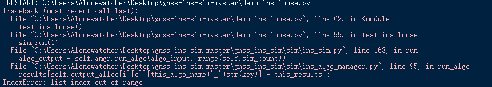
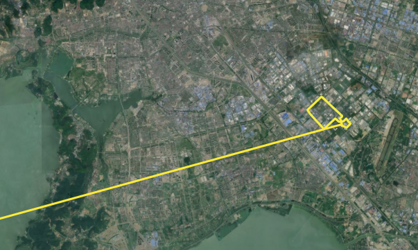
    @Dong-xiaoguang Thanks, the workaround works. However, as i mentioned before, when we use the ins algorithm to test long drive demon, the calculation of error_pos_algo includes the data set when the INS algorithm is initialized, and it is clear that just part of the data set leads to wrong position error.
    ab554999-75de-4740-a19f-7301e19da0e1-image.png
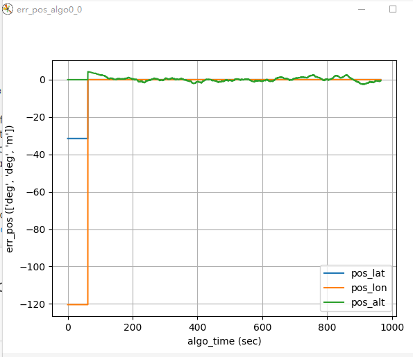
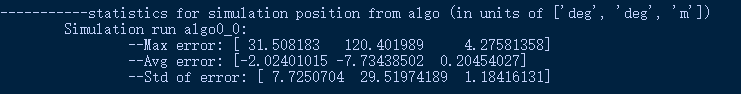
    As a result, the part of the position error statistics in the summary of the simulation seems unreliable. The max error is the initial latitude and longitude we set in motion file, meanwhile, the Std of error is also unreliable.
    9fe448c8-5a68-4a18-bb84-a5b7efcb00ad-image.png
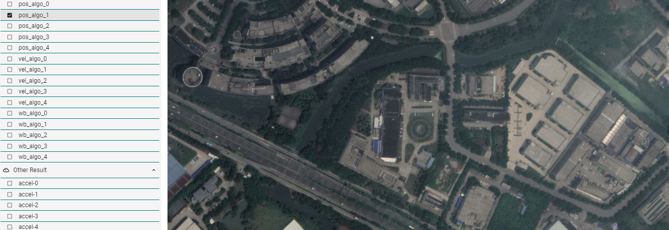
    I tried to manually delete the useless data generated during the initialization in the pos_algo0_0.csv and ref_pos.csv and recalculate the position error statistics by Excel, but the amount of data between pos_algo0_0.csv and ref_pos.csv is different. For the given demo, one is 24000+, and another is 193000+.
    Honestly, i have no idea about how to match the data of the two files.
    Could you give me some advice on this problem?

    Besides, the unit of the simulation position of ins algorithm is [deg,deg,m], but the free_integration is [m,m,m], in my opinion, the latter is more suitable for analyzing the accuracy of simulation results.
    I compared the aceinna_ins.py and free_integration.py in demo_algorithm file to find out how to change the unit of ins result, and found that free_integration import the geoparms from gnss_ins_sim.geoparams, i would like to ask if it is feasible to change the unit by modifying the aceinna_ins.py using related earth parameters.

    Thanks a lot for your patience with me.πŸ˜‚ πŸ˜‚ πŸ˜‚

    posted in The OpenIMU Family •
    RE: Questions about Aceinna Navigation Studio

    @Dong-xiaoguang Sorry to bother you again, as you mentioned, the long tail of trajectory is caused by the INS solution initialization, as a result the error statistics in summary is unreliable. So i download the offline version, but when i try the demo_ins_loose.py in offline version of the simulation, something going wrong.
    Here is the screenshot of error message.
    f8244af0-92ce-4c45-ade6-9fd1c7826c1e-image.png
    I tried to modify the code in ins_algo_manager.py, but failed. Could you give some advice on how to solve this bug?πŸ˜‚

    posted in The OpenIMU Family •
    RE: Questions about Aceinna Navigation Studio

    @Dong-xiaoguang Thanks, everything is clear now.

    posted in The OpenIMU Family •
    Questions about Aceinna Navigation Studio

    Hi,
    Sorry for asking two basic questions about Aceinna Navigation Studio.
    (1) The Introduction to simulation indicate that the ref_pos is generated by true GPS.
    Q: Which measurement method of GPS is used here? Differential GPS or Real Time Kinematic?
    (2) When I use the INS algorithm to do simulation, the reference trajectory and algorithm trajectory are very different. Is there a problem with my settings?
    The screenshots of my model sensor, motion and run are:
    0c525303-911d-4e05-9e00-f1bf86b8fd98-image.png
    The motion generator used is the Drive case comes with system.
    926bcf06-41c7-430a-a206-3437be336db9-image.png
    Here are the screenshots of pos_algo_0 compare with ref_pos( ref_pos is the green line, pos_algo_0 is the yellow line):
    da1f1048-46ae-4ce0-9fff-e86ab762e804-image.png
    d57e7c48-6b43-435d-ac4b-3de5833a4a93-image.png
    For the other four simulations, there is no algorithm trajectory in map_plot, for example, pos_algo_1:
    ff442911-aa81-4b28-b5c0-8b332e7cc31e-image.png

    posted in The OpenIMU Family •
    RE: Can we get INS stand-alone results when GPS signal is not lost?

    @Li-YiFan Thanks for your explanation.

    posted in The OpenIMU Family •
    Can we get INS stand-alone results when GPS signal is not lost?

    Hi,
    I programmed a simple neural network algorithm in python, i need the INS stand-alone navigation results based on free_integration and the GPS/INS integrated results based on EKF algorithm at the same time to test the performance of the neural network.
    How can i get data file includes these two results at same time?
    Thanks in advance.

    posted in The OpenIMU Family •
    RE: Upload Problem

    I'd like to describe my case briefly, by this way, if anyone face a similar problem, you can refer to the solution mentioned above.
    For my case, compiling is success, but after connect the OPENIMUZA300 and PC via ST-LINK/V2, upload problem happened.
    Warning message screenshots are posted in this page.

    posted in The OpenIMU Family •
    RE: Upload Problem

    @cek It works, thank you for your help.

    posted in The OpenIMU Family •
    RE: Upload Problem

    @cek Thanks,i'll try it.

    posted in The OpenIMU Family •